
RIGU REAL ESTATE · NEWS & COMMUNITY
By Rigu Real Estate.
Tropical Storm Simon remains over the Mexican Pacific and is forecast to strengthen rapidly. A Hurricane Watch from Manzanillo to Punta Mita, a stretch of coastline that includes Puerto Vallarta, remains in effect according to Intermediate Advisory 5A from the National Hurricane Center (NHC).
This article reflects the advisory time shown above. For safety decisions, check subsequent updates from the NHC, Mexico’s National Meteorological Service (SMN) and Civil Protection authorities.
Where is Simon, and how strong is it?
According to NHC Public Advisory 5A, issued at 12:00 p.m. on October 8, the storm had the following characteristics:
| Indicator | Information |
|---|---|
| Classification | Tropical storm |
| Maximum sustained winds | 100 km/h |
| Movement | West at 7 km/h |
| Distance from Cabo Corrientes | 580 km south-southeast |
| Center location | 15.5° N, 103.8° W |
| Minimum pressure | 995 hPa |
What is Simon’s forecast track?
The NHC forecasts a turn toward the north-northwest or north between Friday, October 9, and Saturday, October 10, with Simon approaching the southwestern and west-central coast of Mexico late Saturday.
The forecast calls for Simon to become a hurricane on Thursday and reach Category 4 before reaching the Mexican coast. This is a forecast intensity: as of 12:00 p.m., Simon was still a tropical storm. Both the track and intensity may change.
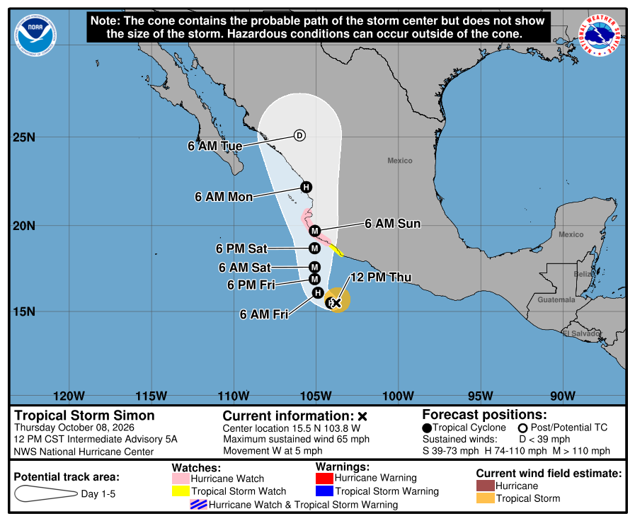
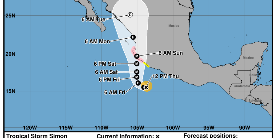
The cone represents uncertainty in the path of the storm’s center; it does not show the storm’s size or every area that could experience hazardous conditions. On the map, S means tropical storm, H means hurricane and M means major hurricane. Read the NHC’s explanation of the graphic.
This forecast track does not confirm that the center will make landfall in Puerto Vallarta.
What could Simon mean for Puerto Vallarta and Riviera Nayarit?
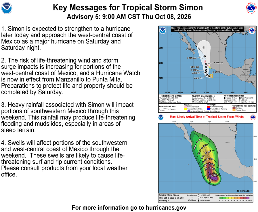
The watch issued by the Government of Mexico and reported by the NHC means hurricane conditions are possible along the Manzanillo–Punta Mita coastline. It does not confirm an impact. The advisory indicates that tropical storm conditions are possible beginning Saturday, with hurricane conditions possible by Saturday night within the Hurricane Watch area.
- Heavy rain: may cause flash flooding, rising rivers and streams, and landslides.
- Strong winds: make it important to secure exposed objects and complete preparations before conditions deteriorate.
- Dangerous surf and currents: pose risks at beaches and for water activities and navigation. The NHC also warns of possible storm surge near and east of where the center makes landfall.
- Activities and services: any closures, restrictions or evacuations depend on local authorities’ instructions; this article does not announce any such orders.
The storm’s outer bands were already bringing heavy rain to parts of southwestern Mexico when the advisory was issued. Regional hazards should not be interpreted as a specific rainfall or wind forecast for every neighborhood in Puerto Vallarta.
Safety recommendations for residents, property owners and visitors
The following preventive measures draw on Civil Protection recommendations published by IMSS and Mexico’s National Civil Protection Coordination:
- Monitor SMN and Civil Protection updates and follow their instructions on shelters, closures and evacuations.
- Stay out of the sea and avoid maritime activities when restrictions or dangerous conditions are in place.
- Secure terrace furniture, plant pots, umbrellas and other objects that could be moved by wind before adverse conditions arrive.
- Check drains, downspouts, doors and windows in advance, and only when it is safe to do so.
- Prepare waterproof storage for important documents, medication, drinking water, food, flashlights and batteries. Consider the needs of anyone who requires assistance and of your pets.
- Do not cross flooded streets, rivers or streams, either on foot or in a vehicle.
- If authorities order an evacuation, follow their instructions and designated routes.
For owners and managers of condominiums, hotels and vacation properties, Rigu recommends maintaining communication with residents and guests, sharing official advisories and checking common areas before conditions worsen.
Official sources and further updates
- NHC Public Advisory 5A: October 8, 2026, 12:00 p.m. CST.
- NHC Forecast Discussion 5: October 8, 2026, 9:00 a.m. CST.
- NHC: latest advisories and maps.
- Mexico’s National Meteorological Service.
- Mexico’s National Civil Protection Coordination.
- Jalisco State Civil Protection and Fire Department.
This article is for information purposes and does not replace Civil Protection advisories, alerts or instructions. The maps are snapshots of the forecast and do not update automatically.